Documenting and Understanding Biochemical Changes Affecting the Sustainability of Tropical Forest Ecosystem Services in Southeastern Brazil
Norton Siano Ribeiro de Freitas and Andrea Lini
The University of Vermont
Environmental Isotope Laboratory, Geology Department
This project demonstrates the use of isotope tracers to map pollutant exposure and the response of native plants biomarkers in the metropolitan area of Campinas, SP, Brazil, spanning urban and rural areas across a major oil refinery pollution gradient where large economic factors are involved. Forests maintain the gaseous composition of the atmosphere stable, detoxify absorbed pollutants and help determine climate. Areas that naturally regenerated into forest patches provide ecosystem services for the benefit of urban residents subject to warmer temperatures, concentrations of pollutants and atmospheric CO2.
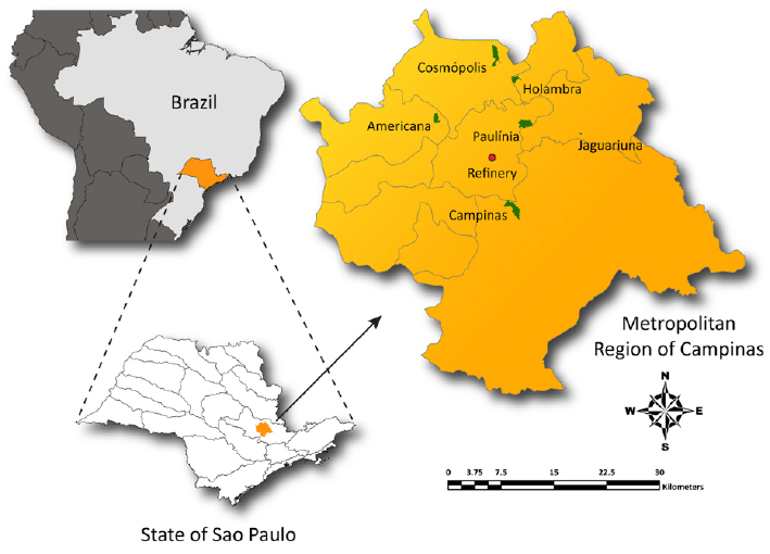
Study area in the state of São Paulo, Brazil
For estimating the effects of multiple pollutants emitted by industrial sources and from changes in land use, a geo-statistical model using atmospheric observations, isotope measurements, geographical datasets and orbital satellite images was developed. We applied local analysis of δ13C, %C, δ15N, %N and C/N on leaf samples, from major plant species collected from native forest plots. In particular, we tracked changes in the isotopic composition of δ13C; analyzed the isotopic ratio of N leaf samples expressed as δ15N; compared the seasonal variability of δ13C and δ15N to extract general trends and increase precision of reported isotopic effects; performed statistical analysis to examine the differences between study sites, seasons and species, thereby observing if species are acting as clear markers for different ecosystem functions.
For broader impact, we depicted results graphically to describe the temporal variability of C and N isotope ratios, indicating where there is a relationship between sampling locations, N content and C/N ratios of the species. Specifically, the model predicts CO2 changes in forest ecosystem processes under normal conditions (small amount of plant species might do the job) and maintenance of ecosystem function under extreme events (variety of plant species provide insurance against external forcing), complementing measurements with spatial mapping of wide landscapes for the ecosystems of interest.